Surveying Services
Hawi Investment’s survey department offers some of the most diverse and experience-based expertise on projects in both the private and public sectors in Kenya. With a number of active, practicing Licensed Surveyors with a staggering number of years of experience with us, the foundation of our survey department is solid and well-rounded.
Our survey field crews have worked on and successfully completed projects throughout Kenya. Outfitted with cutting edge field technology, our staff has conducted boundary, topographical, right-of-way, utility, route location, construction stakeout and GPS surveys for numerous clients across Kenya. Our GPS capabilities enables our field crew’s flexibility and quick response to project demands.
Our office survey staff both supports and compliments our field crews with time tested and proven methods. These procedures have successfully produced deliverables for our clients for years. At Hawi Investments, we believe that our clients’ successes speak volumes about what can be expected when you are doing business with us.
Surveying is the technique, profession, and science of determining the terrestrial or three dimensional position of points and the distances and angles between them. These points are usually on the surface of the Earth, and they are often used to establish land maps and boundaries for ownership, locations like building corners or the surface location of subsurface features, or other purposes required by government or civil law, such as property sales.
The types of surveying we are involved in are:
Cadastral Survey (fixed survey)
Cadastral surveying is the discipline of land surveying that relates to the laws of land ownership and the definition of property boundaries. It involves interpreting and advising on boundary locations, on the status of land ownership and on the rights, restrictions and interests in property, as well as the recording of such information for use on plans, maps, etc. It also involves the physical delineation of property boundaries and determination of dimensions, areas and certain rights associated with properties, whether they are on land, water or defined by natural or artificial features.
Cadastral surveys are generally performed to subdivide land into parcels for ownership under a land title and to re-establish boundaries of previously surveyed properties to determine the physical extent of ownership or to facilitate the transfer of the property title.
A cadastral surveyor is responsible for accurately defining property boundaries and understanding the laws of land ownership. This may include the identification of residential or rural boundaries, re-establishing boundaries that have been previously surveyed or creating new boundaries as part of the land subdivision process.
At Hawi Investments Ltd, our cadastral surveyors have the skill and knowledge to interpret and advice on the location of boundaries and if there are any rights or restrictions relating to the property. The information and measurements taken are then recorded on a survey plan which the surveyor is required to lodge with the relevant government agency.
This means the certificate of title for a nominated parcel of land represents an interest in that land with the registration of that interest guaranteed correct by the State. In Kenya, only registered cadastral surveyors can perform a boundary survey, and place a survey mark that defines a property boundary. Only a registered cadastral surveyor can certify survey plans for lodgment with the government.
Below are the services that we can perform for you:
Property Subdivision
The identification and creation of new property boundaries when a larger property is divided into a number of smaller lots, including when buildings are subdivided for sale or lease of individual units.
Identification Survey (Ident)
A survey that identifies and marks existing property boundaries. This may be required for a number of reasons e.g. to build a fence or to settle a boundary fencing dispute with a neighbour.
Location Certificate
A survey to identify if the real property description in a contract of sale or mortgage document, is the correctly nominated property, e.g. you are not purchasing your neighbour’s property.
Detail or Contour Survey
A survey to identify the location and height of the features on the property. This survey will also identify the slope and the extent of the slope on the property. This survey may be necessary when vacant land is to be developed e.g. a new house being built.
Land Surveying
As qualified and experienced land surveyors we are constantly involved in every element of property boundaries and demarcations; whether it is positioning undefined boundaries or assisting in resolving boundary disputes between neighboring owners.
We are often instructed to act as an expert witness in boundary disputes and asked to provide the court with detailed boundary survey reports, evidence and statements to resolve ownership disagreements.
In addition to the conventional role of the land surveyors we also provide a file plan comparison service to compare existing site features, documented legal plans and site surveys to then liaise with Land Registry in order to resolve problems early in order to prevent boundary disputes occurring.
Topographic Surveys
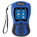
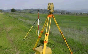
All our survey work is carried out using digital survey equipment like Digital level, Total Stations, Global Positioning System (GPS).
Sometimes called a “contour” survey, this type of survey is used to determine the elevations throughout a piece of property—that is, taking into account not only the horizontal boundaries of your land, but also the vertical features, both natural and man-made (e.g., trees, hills, ravines, poles, walkways, streams, etc.). A topographic survey can serve a number of vital purposes, but especially if you are planning improvements on your land that could affect the landscape.
Finished survey information can be provided on negatives or on computer disks to suit whatever system that the client may prefer. At present we can carry out a site survey, download it onto a portable computer and provide the survey on disk in the same working day. All site surveys are individually priced. Contact us for more information.
Engineering Survey
At Hawi Investments we have a background in design engineering, contracting and civil engineering projects, giving us a detailed understanding of the survey needs and requirements of the design team. As experienced engineering surveyors, we have a proven record of providing accurate engineering surveys for use in design and construction of structural, infrastructure, transportation, environmental and civil engineering schemes.
We can provide accurate and reliable dimension data throughout the construction process from the base topographical survey, cross-sections and ground modeling information to cut and fill calculations, dimensional control to setting-out on-site and finished as-built drawings. The range of projects undertaken have also included more specialist engineering surveying such as railway projects, coastal erosions, tunneling and restricted access site.
Monitoring Surveys
We undertake monitoring surveys to identify movement or deformation in any environment using precise digital levels, movement detectors, precision survey instruments and high accuracy reflectorless total stations. We can map small changes in vertical movement, level and horizontal movement or full 3D XYZ coordinate differences in either real-time or over long periods to demonstrate changes and trends.
With a track record of designing, specifying, installing and completing job specific monitoring campaigns designed to accurately measure and record movement in a large variety of structures and buildings we are able to confidently advise and liaise with Clients and their Architects or Engineers to achieve the best monitoring system to meet their requirements.
From the settlement of buildings or the deformation of civil structures to the movement of natural features and earthworks we can provide a detailed understanding of the dynamics and movements to the highest order of accuracy.
Monitoring projects have included; major bridges and structures, sea defense, soil embankment stability, historic buildings, Steelwork, retaining walls and ground settlement at landfill site.
Power Line Surveys
UAV inspection for the Power and Utility industries
Specific sectors have specific needs. The safety-conscious, cost sensitive Power and Utility industry has reaped significant benefit from using our professional skills in deploying Unmanned Aerial Vehicles (UAV). We can inspect your assets live so you can focus your maintenance teams on repairing identified problems rather than using up valuable circuit outage time for fault finding. We have worked with some of the largest utility companies, currently Kenya Power Company; helping them to improve their maintenance regimes, reducing costs and improving safety.
Estate Management
 At Hawi Investments Ltd we are able to provide a one-stop property service to our portfolio of Landlords and tenants. Our teams of highly trained professionals are committed to providing high levels of service to our customers whilst focusing on the integrated solutions we deliver.
The key services offered are:
Ground Rent Management
We offer ground rent management services to Landlords, Management Companies or Residents Associations. On your behalf we will fulfil all lease obligations:
- Issue rent demand notices on due dates in compliance with Leasehold Act stipulations.
- Collect ground rent directly from leaseholders on the due dates set out in the lease.
- Investigate ground rent arrears.
- Manage rent reviews.
- Mediate and advise on Landlord and tenant issues.
Freehold Purchases and Lease Extensions
- Qualifying leasehold tenants have the right to extend their lease or purchase their freehold under the Leasehold Act in respect of houses, and similar rights are also available for qualifying leasehold tenants in respect of flats under the Leasehold Housing and Urban Development Act
- We offer a complete and integrated process to enable you to purchase your freehold or extend your lease.
Block Insurance
- Standard leases for flats generally include an obligation for either the Landlord to insure, or for the insurance to be placed with the Landlord's nominated agency. There is usually also a proviso to add additional risk cover at the Landlord's discretion.
Property Management
- If your Landlord is responsible for the maintenance and upkeep of your block of flats, we will appoint an agent to deal with these responsibilities on our behalf. We do not deal with maintenance in-house. Please contact our Block Management Department for further clarification.
Consent Services
- If your property has been purchased as a Leasehold interest, you may need the Freeholder’s consent should you wish to make any alterations or additions to your property or in respect of other matters such as sub-letting your property.
- Our consultants will check your lease and provide expert advice on whether or not consent is required.
Solicitors Enquiries
- When a tenant sells a leasehold property the purchaser’s solicitors will generally request certain information from the Freeholder. Typically this will relate to whether the ground rent has been paid up to date and whether the terms of the lease have been complied with.
- Our administration department deals with all these matters for a small fee. In the case of flats, the purchaser's solicitors will probably also need to contact the property manager to obtain information on service charge matters.